Monday, November 22, 2010

Aaron Vincent Elkaim: Jewish Morocco

Photo © Aaron Vincent Elkaim-All Rights Reserved

On the occasion of Passover, I thought of posting an interesting visual-historical-religious photo essay relating to the long Judeo-Muslim history of Morocco by Aaron Vincent Elkaim.

Jewish history in Morocco dates back to over 2000 years, and Jews have lived in the country as a protected minority. Prior to the arrival of the French in 1912, the currency and flag of Morocco carried the star of David, a recognition that it represented a prophet revered by Jew and Muslim (as Dawood) alike. During the Second World War, the king of Morocco famously declared to the Nazis (who wanted a list of Jews) that there were no Jews in Morocco, only Moroccan citizens.

Following the establishment of Israel, most of the Moroccan Jews have left their country of birth for the USA, France, Canada and Israel itself.

Aaron is an emerging documentary photography who initially studied Film and Cultural Anthropology at the University of Manitoba. His work was awarded on numerous occasions and published in newspapers and magazines across Canada.

His photographs in the mellahs of Marrakesh and Essaouira remind me of my own at the synagogues in these two cities last summer, during the Essaouira Gnawa festival.

New Bridge to be Opened to Machu Picchu

Good day fellow travelers. As I am sure some of you already aware, a new bridge is about to be opened near the base of Machu Picchu. I thought I’d address this issue in my latest blog entry and ask what exactly it is this bridge will do for the region, what implications the bridge has for Peru’s most sacred site, and what can we do about it?

Sometime back I heard that the mayor (now former mayor) of Santa Teresa – a small town less than a stone’s throw away from Machu Picchu – was planning to have a bridge built crossing the Vilcanota River. This bridge will be inaugurated in February. As I began to wonder about the implications this bridge might have on Machu Picchu and tourism in the region, a storm of arguments arose in the international media regarding the issue. On the one hand people argue that the bridge has the potential of so over-crowding Machu Picchu with tourists that both the hallowed ruins and regional ecology will be destroyed; on the other hand people are arguing that the residents of Santa Teresa – long cut off from the rest of the world – deserve a bridge with which they can more easily reach Cusco and make a living. In Peru the dispute over the bridge is very heated, and so with this blog entry I thought I’d attempt to tackle the problem in order to hopefully shed more light on it for those of you who are interested.

Traditionally there has only been one way to reach Machu Picchu, that being by taking the train from Cusco to Aguas Calientes, the town closest to Machu Picchu. In reality there is another way – through Santa Teresa – but in order to get there one has to travel over a network of very nasty roads. The 20 or so hour drive from Cusco to Santa Teresa leads through jungle swamps and over cliff faces with drops so unimaginably high that sky diving aerialists would shudder in fear. This route has been the only road the residents of Santa Teresa have been able to use to take their produce to Cusco. One does however need to take into account the wider repercussions the bridge could have on the ruins, the region, and even the country as a whole.

The base concern presented against building the bridge is that it will bring in such an influx of tourists that both the ruins and ecology of the region could be badly damaged. Remember that one of the major sources of Peruvian income is tourism, and a that the major source of Peruvian tourism is Machu Picchu.

The price of crossing this bridge on a bus from Cusco is estimated to cost somewhere in the region of four US dollars. Anyone who has ever been to Machu Picchu will know how much of a price cut this is on the train ticket. The amount of people traveling to the ruins is estimated to shoot through the roof with figures this low. The development of a new tourist infrastructure needed to cope with such an influx of tourists in the area would of course also be hugely detrimental for the ecology of the surrounding area, as well as for the ruins themselves. And so understandably many environmentalists/cultural activists are calling for the bridge to be closed – perhaps even destroyed.

Machu Picchu currently receives over 4000 tourists a day, that’s just shy of 1,500 000 tourists a year. It is hardly a wonder that UNESCO is currently in the process of changing their classification of Machu Picchu to an Endangered World Heritage site. The UN group is in fact at the moment engaged in talks with the government that would have them drop the number of tourists permitted to enter the site from 4,000 to 2,500. If anything this shows how dire the problem already is. With the new bridge however, the number of visitors could likely so overly surpass the current levels of tourists visiting Machu Picchu that the ruins may quite likely disappear, making the many efforts that people have made towards their preservation futile.

Another argument against the construction of the bridge is that it provides a much shorter route for local Coca Farmers to transport both coca paste and cocaine to urban areas, from where it is transported and shipped overseas. Still, some people argue that a more accessible road to open up this region would hardly make the transport of drugs easier, but would more likely make it harder as police and military would be able to make their presence more felt in the area.

And so this is how it stands. On the one hand we have a national treasure that is under threat, and on the other we have a group of people who are effectively being denied the right to an easier way of life. It’s a tough argument and both sides have their points. I would of course choose to preserve Machu Picchu at all costs, but there’s also the real need of a community trying to develop itself in order to better the lifestyle of its people. So I guess a compromise between the two arguments would be the best result of this dilemma – a compromise I have heard a few people talking about already.

One feasible solution would be to open the bridge and disallow tourists the right to cross it. This would benefit both the people of Santa Teresa and the majestic ruins themselves. This approach would however also deny those who would be otherwise unable to afford getting to the ruins a chance to see them.

Obviously losing Machu Picchu is a nightmare Peru will never actually allow – the country relies too much upon it economically. What is worrying however, is how long it will take to put the effective wheels into place that will advert this tragedy. If it takes too long, how much of an impact will have already been made?

It is a complex situation with many differing arguments and points of view. Please take my points of view and opinions as they are – a means with which to more clearly envision the depth of what could be a difficult situation for Peruvians and travelers alike. For those interested in finding out more I suggest you look into the following websites:

I hope that some of you may have found this helpful and interesting. If anyone out there has a point of view regarding the situation please feel free to post a comment and we can further discuss it.

To all you travelers out there – Keep on discovering!

Bart

www.cat-travel.com

The Nazca Lines and Back to Lima in One Day

Good day again to you all and a very happy and belated new year! I wish you all the very best for the year and hope that you all manage to get out and travel to some extraordinary places in 2007. It has been sometime since my last post – and this is mostly due to the fact that we’ve been busy working on the new class adventure travel website – www.cat-travel.com. It is also partly due to the fact that my family and I have spent a lot of time traveling around Latin America looking out for new tours, destinations, and new offices for CAT – in such places as Chile and Costa Rica. My first entry for the year however concerns itself with the Nazca Lines and how getting there, seeing the awesome sight of the lines, and getting back to Lima can now be done in one day.


Approximately 2000 years ago the Nazca Culture – for one reason or another (the theories are endless) – decided it would be in their best interest to carve giant geometric designs, patterns, and stylized animal figures into the surface of a rather flat, inhospitable, and barren plain. Whether in fact the Nazca people created the lines to appease the gods, or whether they made them simply in order to confuse us is largely immaterial, especially as the reasons behind their creation have been debated for so long that any hope of finding a concrete explanation for their existence seems to have disappeared. What hasn’t disappeared however, are the lines – and after 2000 years they are as resplendent, mind boggling, and impressive as ever.

The town of Nazca lies about 450 kilometers south of Lima and the amazing geoglyphs, located on the plateau outside of town never fail to dazzle me. What does annoy me is that if you’re on a limited time frame it’s a difficult site to see. Traditionally one has always had to take a bus from Lima to Nazca which takes roughly seven hours. It actually took me nine hours to get there by bus a couple of years ago. What this means is that unless you really want to spend some time exploring the region –you’re looking at a two day trip at the very least. If the bus is fast you can get there and back in 14 hours. It’s a large price to pay considering the Cessna flight over the lines only lasts 30 minutes. This rather time consuming, line viewing haul is no longer necessary though.

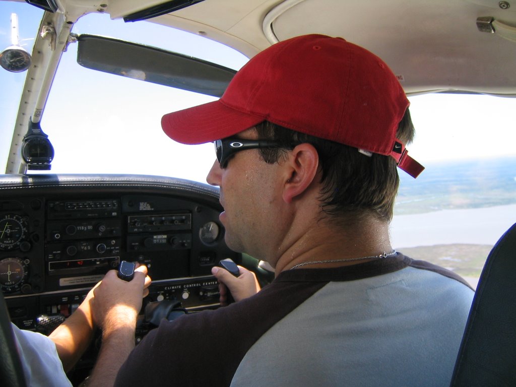
I recently discovered – to my pleasure I should add – that it is now possible to see the Nazca Lines in one day from Lima. A flight in the morning takes you to Ica – where you board a Cessna and fly directly over to the Nazca Lines. The trip over the lines lasts a little longer owing to the distance, and after returning to Ica one can enjoy a little seafood lunch, lounge about comfortably at the swimming pools at Las Dunas hotel, and even try some famous Huacachina sand-boarding before returning to Lima on a late afternoon flight.

I did this trip recently and found it to be not only a great way to get to see the lines, but also found it to be rather relaxing. It’s a little fast paced, but you are given plenty of time to sit around and catch up on some reading. I’d recommend this trip to anyone pressed for time while traveling in Peru, as well as for those who like to get things done comfortably and quickly. On the other hand there is a lot to be said about Nazca and other sites in the area. The Hacienda Cantayo, located on the outskirts of town, is possibly one of the finest hotels in Peru and is definitely one of my personal favorites. Another reason to stay in Nazca is to see the rather eerie - although fascinating - ancient bone cemetery of Chauchilla on the outskirts of town. So there are things to see and do in the area if you want to take your time. It is however, nice to know that we now have the option of getting down to Nazca, seeing the lines, and getting back to Lima in a day.

I hope this helps anyone interested. Keep on traveling!

Bart

www.cat-travel.com

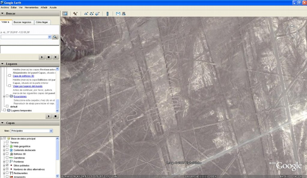
By the way, I noticed that you can now find the Nazca Lines on Google Earth if you look hard enough. For those of you interested, search the Nazca Plain that lies in the vicinity of 14°41'00" S and 75°07'00" W.

Sunday, November 21, 2010

POV: iPad

Photo Courtesy WIRED-All Rights Reserved

I'm far from being a geek or remotely resembling one, but I still like gadgets provided they're useful and have a purpose...which brings me to the iPad.

Unless you're traveling in North Korea, you must've heard that Apple is launching its iPad in its stores this coming Saturday. I live not too far from its 14th Street store and I intend to walk by just to see the gawking crowds.

The New York Times' David Pogue has an interesting article (and well-balanced) titled Looking At The iPad From Two Angles which I found to be the most intelligent of whatever has been recently written about the device. He concludes the article with this:
"The bottom line is that the iPad has been designed and built by a bunch of perfectionists. If you like the concept, you’ll love the machine. The only question is: Do you like the concept? "
And that's the question. The iPad is really a "looker" not a "doer"...in other words, like its midget cousin the iTouch, it'll be mainly used as a reader, as a viewer of text, of website (minus Flash), of emails, of pictures, and so forth. Its success or failure is also dependent on the available applications, current and future, which I understand are close to 1500 in number already.

So far, I haven't seen any merits for photographers to get one. I read somewhere that an enterprising photographer will buy a few and, when asked for his portfolios, will send them out to his best clients instead of the old-style books. I'm quite certain that the iPad will be great in impressively displaying our images, but that's all.

Will it be fun to have an iPad? Of course, but will it be useful? I don't know. I'll wait and decide in another 6 months. Let others be the testers.

WIRED has a roundup on the first reviews of the iPad.

A Trip for Two to Kuelap: the second Machu Picchu

Good day fellow travelers – It has been a while since we met and I thought I’d write something up on a recent return trip my wife Karin and I undertook to Kuelap, and how traveling to these amazing Northern ruins has become a lot easier over the past ten years.

My first trip to Kuelap was a ten years ago and was none to easy, but if you’ve spent some time traveling you’ll agree that on some occasions, the harder a place is to get to - the more worthwhile it is once you get there.


Photobucket - Video and Image Hosting

The beauty of Kuelap far outweighed the hardships of getting there, and so it was with very little hesitation and a lot of excitement that Karin and I set off once more to return to Peru’s secret ruins. Ten years ago I was fascinated by the enchanting ruins of Kuelap – described by many as a second Machu Picchu – and ever since then I have been eagerly trying to getting myself back there. Well, I was in Peru recently with Karin, and with some spare time on our hands we set off once more for what would be an inspiring trip up north.

To reach Kuelap one has to spend a few nights in Chachapoyas, a mountain town only accessible by road from either Cajamarca or Chiclayo. The route from Cajamarca passes though the Utcubamba Valley and provides superb views from a road that is literally carved into cliff faces thousands of feet high – it is visually stunning but can be very dangerous. Ten years ago Karin and I took the overnight bus from Chiclayo. We arrived early in the morning and after having spent the entire evening bouncing around on wooden seats at the back of a bus, we were tired, bruised, and in some serious need of sleep. At present however things have changed, one can now arrange private transport to Chachapoyas and the roads are in a better - albeit not perfect - condition. What this means is that the proverbial ‘pain in the ass’ has both literally and figuratively been removed from the trip. We were driven in private transport, were able to stop and walk around at sites on the way, and managed to get some sleep on route. I actually felt refreshed when we reached Chachapoyas this time around.

Photobucket - Video and Image Hosting


Surprisingly few tourists make it to Chachapoyas which I find remarkable; not only is it close to the ruins of Kuelap and a number of other attractions in the area, but over the years it has become increasingly more accessible to reach. It’s a laidback town, one of the most scenic in Peru, and perhaps one of my favorites. Outside the hotel a local kid proudly tells me that Chachapoyas means ‘Misty Mountain’ and that Chachapoyans are all ‘Cloud Warriors’. And who am I to disagree? - Clouds float through the town at eye level, and while the townsfolk seem too friendly and laidback to ever be warriors – they are said to be descendants of the Chacha culture that built Kuelap and warred with the Incas.

Nowadays private tours run daily to Kuelap from Chachapoyas leaving at about 8am and returning at about 4 or 5pm the same day. This doesn’t mean there are hordes of tourists visiting – on the contrary there are very few indeed. What it does mean is that one doesn’t have to spend 3 days waiting to get to the ruins as I had to ten years ago.
Even though Kuelap is only 27km from Chachapoyas (as the crow flies) – the drive there today can take up to three hours. It’s a rough drive it must be said that it scarcely compares to the hardships I went through in getting there the last time. On my first trip I was assigned to the rattling back seat of a collectivo (a minivan) with a couple of chickens and a collection of rusty farming implements for no less than seven hours. This time around I got to enjoy the stunning views over the canyons and ravines on the way there from a comfortable car seat, and we even stopped in one of the local villages to enjoy a fantastic Chacha lunch on the way back.

Ten years ago I finally arrived in Kuelap after taking a 14 hour bus ride to Chiclayo, an 11 hour bus ride to Chachapoyas, a hellish 7 hour ride in the back of a collectivo, and a half an hour steep hike. Minutes before I set my eyes on Kuelap I wondered whether it would all be worth it.

It is. Believe me.

Photobucket - Video and Image Hosting


And it still is now. Only this time round I actually enjoyed getting there.

Like the time before - I strolled around a corner and quite unexpectedly, there it was – towering yellow walls amid an explosion of vivid plant life. Groups of Llamas graze on green grass while being dwarfed by the gigantic walls of Kuelap, which appear barely able to restrain the natural overgrowth spilling down their sides. It took my breath away once again.

It is very easy to see that Kuelap was built as a fort; it is quite literally impenetrable and it is no wonder it took the Inca so long to conquer the Chacha people. Entering through the very narrow yet impressive entrance way we arrived within the complex to find an extensive number of ruins hidden under a jungle of brightly colored Air-plants, Bromeliads and Orchids. As with my first visit to Kuelap, I was filled with this inexplicable contentment – I had the same feeling when I first visited Machu Picchu, and while both places are very different from one another, they inspire the same kind of awe and admiration one reserves for sacred sites.
Photobucket - Video and Image Hosting


This time around, one of the most extraordinary parts of the trip to the ruins for Karin and I was that we were there for the better half of an entire day and were, save for the guide who had brought us, completely alone. We did not see another face, Peruvian or foreigner, for the entire time we were there. Ten years ago there had been a few other foreigners on site – but this time there was no one. We spent most of the day walking through the labyrinth of forgotten ruins and temples, and were filled with a sense of peace and isolation. Besides taking the occasional picture – there isn’t very much to do in Kuelap other than sit and admire the ruins in wonder and contentment. In the early afternoon we returned to the car for the ride back to Chachapoyas.

Once again Kuelap lived up to my expectations. Easier to get to this time around, my feelings of awe and my veneration for this sacred site are no different today as they were upon my first visit. Kuelap certainly has something very special about it, something I will never forget, and something I definitely want to see again.

Go for it – and keep on traveling

Bart

Useful Information on Kuelap


Photobucket - Video and Image Hosting


  • Kuelap is the largest ancient building in the Americas and is estimated to contain 3 times more stone material in its construction than the largest pyramid at Giza, Egypt.
  • Only 1% of tourists visiting Peru journey to the north of the country and only a tiny fraction of these few visit Kuelap
  • At 3000 masl, Kuelap’s outer walls measure 600 meters in diameter in some areas and are as high as 19 meters in others
  • Kuelap contains over 400 buildings within its walls with three distinctive sections, the first for the commoners, the second for the military, and the third for the royalty and high priests
  • The Chacha culture, about whom very little is known, began building Kuelap circa 800AD
  • Towards the beginning of the 16th century the Incas took control of Kuelap after a lengthy war, only to abandon it when the Spanish arrived in the middle of the same century.
  • There are plans to possibly build a cable car up to the Kuelap fortress. While this project may take some time to be implemented, it will be much less detrimental on both the culture and environment around Kuelap when mass tourism discovers this amazing secret.


Travel Advice and Tips

Photobucket - Video and Image Hosting


  • Keep your eyes open for blond haired, blue eyed locals in the area. Many theories surround the origins of these people who claim to have no European ancestry whatsoever. One such theory is that they are the direct descendants of the Chacha people whom the Inca described as a ‘tall and fair’ race
  • Make sure you take a lot of water and a small snack on your tour of Kuelap
    El Chillo is the best hotel in the Chachapoyas area and is well worth checking out, but do not expect any luxury there.
  • There is far more to the region than just Kuelap. If you have some extra time you should visit Revash, Yalape, and the cliff hanging Karajia Sarcophagi close to San Miguel de Cruzpata, which featured in National Geographic some years back. All are very impressive sites
  • If you can, take a private tour to the ruins. Not only is the ride more comfortable, but its faster, safer, and provides a more personal experience

Saturday, November 20, 2010

The Sabarimala Pilgrimage: Asim Rafiqui

Photo © Asim Rafiqui-All Rights Reserved

It's always a pleasure to start off the month with a super interesting post.

Here's a religious event/festival that not only fires up my adrenaline and imagination, but whose descriptive details I savor with relish, particularly as these are written by one of my favorite writers, William Dalrymple, and photographed by one of my favorite photojournalists, Asim Rafiqui.

And naturally, this event (as one of the largest pilgrimage festival in southern India) will be added to my list of possible destinations for a photo~expedition in 2011 or beyond. Not as overhyped as the Kumbh melas, it's the sort of authentic event I would love to photograph and attend...and then produce photo-essays and audio slideshows. It is this kind of destination that I seek for my photo~expeditions, which are destination/event-driven rather than just hopscotching from one tourist spot to the other. The trek up to the temple takes a minimum of five hours on a crowded path and unfortunately, women aged 10-60 are excluded from the pilgrimage.

The festival is the Sabarimala pilgrimage, and it brings Hindus and Muslims together in a fashion that is seldom witnessed. It would be redundant for me to re-post what Dalrymple describes, so here is his article as published in The Guardian.

Here's Asim's post in his opus; The Idea of India, and in which he writes:
"Here, in this small town in Western Kerala, members of two communities have managed, through legend, lore and ritual, to create a shared spiritual and social space and bridged what many claim is an insurmountable divide. The Sabarimala pilgrimage, in the course of about forty days, will bring nearly 50 million pilgrims through this town, and to the Vavar mosque. The seventy kilometer trek from Erumeli to the mountain top shrine of the god Ayyappa at Sabarimala cannot be completed without first paying respects to his friend the Muslim pirate/saint Vavar and asking his permission to proceed."
Asim meets a guruswami who invites him to join his group to Sabarimala and, being of a different persuasion, assumes wrongly that the invitation was only rhetorical. As the guru leads his group towards the mountain shrine of Ayyappa, he waves and tells Asim that perhaps Ayyappan did not call him yet, but that when he was ready he'd ask him to come.

I hope Ayyapan includes me as well.

Friday, November 19, 2010

Paulette Waltz: Tibetans In Exile

Photo © Paulette Waltz-All Rights Reserved

Here's an audio slideshow of black & white photographs of the Tibetan community in Manali by Paulette Waltz.

There are 3 Tibetan monasteries in Manali; two of which are located in the main downtown area of Manali, while the third monastery is on the opposite bank of the Beas river. In common with other Tibetan communities, there are a number of handicraft stores and restaurants. The two I frequented -while teaching at the Foundry Photojournalism Workshop- was Chopsticks (not much imagination in the name, but decent and cheap food) and the delightful Peace Cafe which served a wonderful granola and yogurt breakfast, as well as noodle soup and other staples.

Paulette Waltz lives and works in Tokyo, but was born and raised near Washington, DC. She pursued Psychology at Emory University, studying in Europe and Africa. Post-graduation, she traveled Asia and lived in northeast China as well as Japan. She developed her interest in photography in Namibia, where coming across photogenic Himba women.